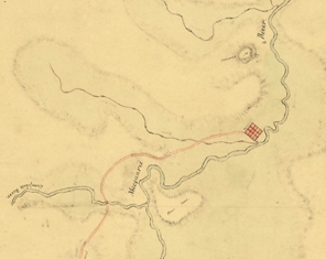
 A 'lost' historic map of the first road over the Blue Mountains to Bathurst has been 'found' online by a Charles Sturt University (CSU) history researcher.
Dr Rob McLachlan, adjunct senior lecturer in history at the CSU School of Humanities and Social Sciences, has been conducting research for Bathurst Regional Council in the lead-up to the 2015 bicentennial celebrations of the establishment of Bathurst as the first inland settlement in Australia.
Dr McLachlan's 'discovery' in May this year of a digital copy of the map on the National Archives (UK) website is remarkable because it was seemingly unknown to historians researching early inland developments. His find broadly coincides with the bicentenary of the July 1814 start of construction of the first road into the interior of Australia by a working party under the command of William Cox. The road was completed by early 1815 and the then governor of New South Wales, Governor Lachlan Macquarie, travelled its length to the government depot where the road terminated on the banks of the Wambool River, then re-named the Macquarie River. Here he formally named the new settlement Bathurst on 7 May 1815.
"I have been working for Bathurst Regional Council over the past year or two researching and interpreting the first settlement site," Dr McLachlan said. "One of my tasks has been to locate early maps, plans and pictures of the early settlement and environs held by major libraries and archives, and then acquire high resolution digital scans for our now extensive digital collection.
"In early May this year I had a tip that the ground plan and front elevation of the Bathurst convict hospital might be held by the National Archives (UK) in London. I went online to have a look at their website, expecting only to find an archival reference to a file. But, feeling lucky, I thought I might just see if it was in their digital image library. This was long odds, but my luck was good and there was a digital full-colour copy of the plans.
"Surprised by my find, I carried on to see what else might be in their image library and after sifting through hundreds of entries, I came across something that was literally gobsmacking. It was the hitherto 'lost', or at least misplaced, map drawn up in 1815 showing the full extent of Cox's Road from Emu Plains all the way to Bathurst. Titled 'Map of the Country Westward of the Nepean River', it is an impressive hand-coloured but faded map measuring about 1.2 metres by .7 metre.
"This was the map that accompanied Macquarie's despatch to London in June 1815 reporting on the completion of the road and his trip to Bathurst in May."
Dr McLachlan was very puzzled by this map being on the Internet and, to the best of his knowledge, not referred to by any historians researching and writing about the history of Cox's Road. He made enquiries to leading historians of the road. All replied that this map was not known to them.
"They had never seen it before I brought it to their attention," he said. "In other words, this map is a fresh contribution to research about this famous foundation road. As well, it appears to be the only contemporary map of Cox's Road over its entire length. There is certainly no contemporary map showing how the road reached Bathurst from Campbell's River, but this map shows the route and is literally the missing link."
Dr McLachlan does not claim to have 'discovered' this map, but simply to have located it on the Internet in the collection of the National Archives (UK), and is now trying to make its existence known to historians and others interested in Cox's Road.
To find the map on the Internet, go to the National Archives (UK)'s Image Library search page. (This URL can be used: www.nationalarchives.gov.uk/imagelibrary/) Search on CO 700/NEWSOUTHWALES24. A digital copy of the map can be purchased online for £35.


Social
Explore the world of social